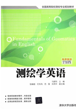
测绘学英语 / 全国高等院校测绘专业规划教材
定价:¥38.00
作者: 马振利,张继超等
出版时间:2014-07
出版社:清华大学出版社
- 清华大学出版社
- 9787302363088
- 1-1
- 118622
- 45158751-3
- 平装
- 16开
- 2014-07
- 483
- P2
- 测绘
- 本科
内容简介
由马振利主编的《测绘学英语(全国高等院校测绘专业规划教材)》按照国内多数高校测绘工程专业“数字测图原理与方法”课程大纲要求,结合中国测绘技术现状并参考英美等国测绘技术特点,采用全英文系统地介绍了测绘学基础的理论与技术,包括:测绘学(Geomatics)的基本概念与发展变革、高程测量、角度测量、距离测量、误差理论与简易平差方法、小区域控制测量、大比例尺数字测图和地形图应用等教学内容。每章均附有习题和参考答案,附录中还包括以中文总结了该课程的知识要点和该教材中出现的500余条术语的英中文对照。
该书可以作为本科“数字测图原理与方法”课程进行双语教学和“测绘英语”课程的教材,也可以作为研究生相关课程的教材和测绘工程技术人员的参考书。
该书可以作为本科“数字测图原理与方法”课程进行双语教学和“测绘英语”课程的教材,也可以作为研究生相关课程的教材和测绘工程技术人员的参考书。
目录
Chapter 1 Introduction
&1.1 DEFINITION OF GEOMATICS
&1.2 BRANCHES OF GEOMATICS
&1.3 HISTORY AND DEVELOPMENT OF GEOMATICS
Problems and Exercises
Chapter 2 Basic Concepts of Surveying
&2.1 THE EARTH, GEOID AND ELLIPSOID
2.1.1 The Shape and Size of the Earth
2.1.2 Geoid and Ellipsoid
2.1.3 Reference Ellipsoids
&2.2 POSITIONING OF POINTS ON THE GROUND
2.2.1 Independent Planar Coordinate Systems
2.2.2 Geographic Coordinate Systems
2.2.3 Gauss-Kruger Planar Coordinate System
&2.3 RECTANGULAR COORDINATES
2.3.1 Reference Directions
2.3.2 Azimuths and Bearings
2.3.3 Principle of Coordinates Computation
&2.4 INTRODUCTION TO MAPS
2.4.1 Maps
2.4.2 Map Scales
2.4.3 Contours
Problems and Exercises
Chapter 3 Leveling
&3.1 GENERAL BACKGROUND
3.1.1 Leveling Terms
3.1.2 Vertical Datum of China
3.1.3 Principles of Direct Leveling
&3.2 CURVATURE AND REFRACTION
3.2.1 Effect from the Earth's Curvature
3.2.2 Effect from the Atmospheric Refraction
&3.3 LEVELING METHODS
3.3.1 Vertical Distances Measuring
3.3.2 Direct Leveling
3.3.3 Barometric Leveling
3.3.4 Trigonometric Leveling
&3.4 EQUIPMENT FOR DIRECT LEVELING
3.4.1 Telescopes
3.4.2 Level Vials
3.4.3 Tilting Levels
3.4.4 Automatic Levels
3.4.5 Electronic Digital Levels
3.4.6 Hand Level
3.4.7 Leveling Tripods and Rods
&3.5 FIELD AND OFFICE WORK FOR LEVELING
3.5.1 Operation for Leveling
3.5.2 Differential Leveling
3.5.3 Office Work in Leveling
&3.6 LEVEL TESTING AND ADJUSTING
3.6.1 Requirements for Level Testing and Adjusting
3.6.2 Parallax Adjusting
3.6.3 Circular Level Testing and Adjusting &i
3.6.4 Preliminary Adjustment of the Horizontal Cross Hair
3.6.5 Sightline Testing and Adjusting (Angle i Testing)
&3.7 SOURCES OF ERROR IN DIRECT LEVELING
3.7.1 Instrumental Errors
3.7.2 Personal Errors
3.7.3 Natural Errors
3.7.4 Mistakes
3.7.5 Errors Reducing and Mistakes Eliminating
Problems and Exercises
Chapter 4 Angles Measurement
&4.1 GENARAL BACKGROUND
4.1.1 Reference Directions for Vertical Angles
4.1.2 Meridians
4.1.3 Horizontal Angles
4.1.4 Azimuths
4.1.5 Bearings
4.1.6 Reverse Azimuth
4.1.7 Azimuth Calculations
&4.2 THEODOLITES
……
Chapter 5 Distance Measurement
Chapter 6 Theory of Errors and Survey Adjustment
Chapter 7 Control Surevy for Small Areas
Chapter 8 Topographical Mapping with Large Scales
Chapter 9 Application of Topographic Maps
Appendix A 《测绘学基础》知识要点与习题答案
Appendix B Vocabulary in Geomatics
References

